
Negotiations with Puniu (Shanghai) Technology Co., Ltd.
September 17, 2025
Shanghai, China
10-13 June 2024
Oslo, Norway
Next Generation Geophysical Land & Shallow Water Acquisition
23–25 April 2024 JW Marriott Hotel Muscat, Oman
June 2023 г.
Vienna, Austria
83th EAGE Annual Conference&Exhibition 2022
June 2022 г.
Madrid, Spane

This Windows©-based software suite supports automated onsite seismic data QC.
The software is designed to evaluate, visualize and map seismic recording quality attributes.
This software is recommended for:
This software may be installed on a desktop or laptop computer.
The following hardware configuration is recommended for best performance:

This software requires seismic data in SEG-Y format with acquisition geometry or SEG-D data sets and SPS-files containing acquisition geometry data. The SeisWin-QC® Suite contains SEG-D to SEG-Y converters and a tool for importing geometry data from SPS-files.

Once a project is set up, you can visually check the acquisition geometry on a coordinate grid and quickly retrieve any field record using its ID (FFID) or location coordinates.
Click the thumbnail to see a larger image.
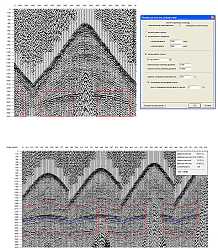
SeisWin-QC® supports evaluation of several seismic data quality attributes, including:
Click the thumbnail to see a larger image.
All the attributes above are used to calculate the overall quality index using our proprietary formula:
/ (0.7+0.7+0.7) x k")
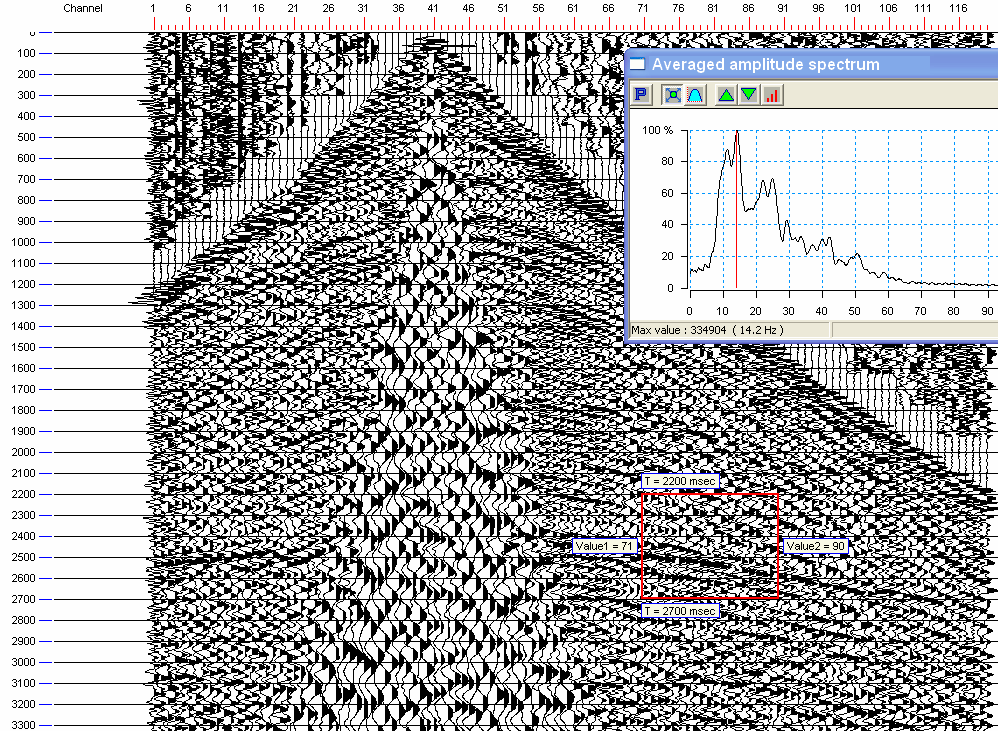
You can set customizable time-space windows to evaluate quality attributes. The window may be set by dragging your mouse over the displayed data set or numerically through a dialog box. The space window may be rectangular or may follow the shape of the normal moveout curve.
Click the thumbnail to see a larger image.
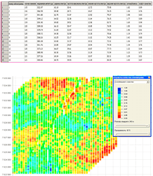
The main outputs of the processing are sets of quality attributes characterizing individual field records. The results are displayed as a table in the main interface window, and as a color-coded attribute map on a coordinate grid. The software also supports statistical analysis and data selection based on attribute values.
Click the thumbnail to see a larger image.

The results of quality attribute evaluation may be saved to an ASCII file and used as input data for attribute mapping in any mapping software (e. g., Surfer).
Click a thumbnail to see a larger image.
| TYPES OF PROCESSING | AMOUNT OF INPUT DATA | TIME NEEDED |
| 2D line quality attribute evaluation |
500 records x 240 channels |
10 minutes |
|
3D line quality attribute evaluation |
Daily throughput: |
1 hour |
|
10,000 records x 1,500 channels: |
Less than 20 hours |
|
|
2D stacking:
|
500 records x 240 channels |
15 minutes |
|
3D swath stacking |
500 records x 1,500 channels: |
1.5 hours |

