
Negotiations with Puniu (Shanghai) Technology Co., Ltd.
September 17, 2025
Shanghai, China
10-13 June 2024
Oslo, Norway
Next Generation Geophysical Land & Shallow Water Acquisition
23–25 April 2024 JW Marriott Hotel Muscat, Oman
June 2023 г.
Vienna, Austria
83th EAGE Annual Conference&Exhibition 2022
June 2022 г.
Madrid, Spane
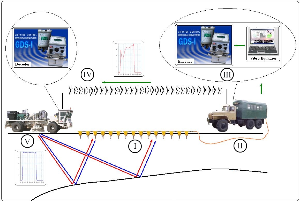
The AViSeis® adaptive vibroseis technology is an innovative field survey method that builds on the proven track record of conventional vibroseis.
Unlike the conventional vibroseis technology that uses one sweep signal for the entire survey line or survey area, AViSeis® employs non-linear sweep signals to match the geologic settings at each shot point.
This overcomes the limitations of the conventional vibroseis technology and allows making real-time adjustments for variations in surface and subsurface environments throughout the survey area.
AViSeis® adjusts sweep signals for each shot-point automatically by analyzing seismic records from the target depth interval and applying the results of inversion to subsequent sweep signals.
The use of AViSeis® technology results in expanded signal spectrum, better seismic resolution and more consistent amplitudes throughout the survey area.
The AViSeis® technology is supported by GDS-II®, our new certified vibrator control system, complete with RF transceivers and GPS/GLONASS receivers, and EQUALIZER software that is compatible with all available vibrators and seismic stations.
The AViSeis® flow chart:
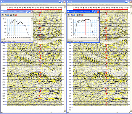
Correlated vibroseis records (linear sweep, 10-92 Hz – left; adaptive sweep – right) and their amplitude-frequency spectra (top – sweep; bottom – reflection)
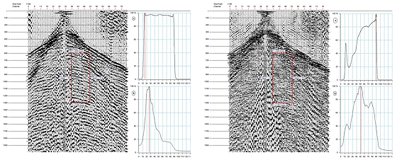
Mouse click to enlarge
Preliminary time sections: linear sweep (left) vs. adaptive sweep (right)

Mouse click to enlarge
| Correlogram amplitudes and frequencies for the target reflection interval: 50% adjustment (top) and 100% adjustment (bottom) | Changes in sweep (top) and reflection (bottom) amplitudes and frequencies depending on «noise factor» settings |
 |
 |
Mouse click to enlarge
Changes in the generated sweep signal and recorded signal spectra along the survey line. Time sections: linear sweep (top) vs. adaptive sweep (bottom)
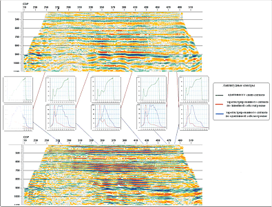
Mouse click to enlarge
Changes in adaptive sweep signal dispersion depending on surface conditions

Mouse click to enlarge
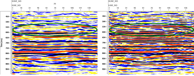
The final time sections 2D with a linear (left) and adaptive (right) sweep (the north of Western Siberia)
Mouse click to enlarge
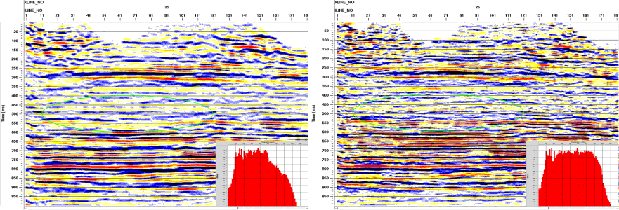
Segments of final stacks along a test survey line using linear sweep (left) and adaptive sweep (right)
Mouse click to enlarge
Linear-sweep (left) and adaptive-sweep (right) time sections from a salt-dome area and the corresponding spectra after travel-time correction
Mouse click to enlarge
Time sections from linear sweep vibroseis (left) and AViSeis® (right)

Mouse click to enlarge
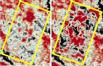
Constant time slices for 3D data from the northern part of Western Siberia (700 ms, Cenomanian): conventional 3D survey with linear sweep (left) vs. AViSeis® (right).
Mouse click to enlarge
Synthetic sonic log: conventional vibroseis (left) and AViSeis® (right)

Mouse click to enlarge
Development of Adaptive vibroseis methodology is based on the results of theoretical and experimental works, obtained by employees of Geopfysical Data Systems Ltd.in this area.

